A history of crop forecasting in 3 maps
At Arable, we’ve just been awarded a National Science Foundation SBIR Phase II grant to advance forecasting of timing, quality, and yield in specialty crops (fruits, vegetables, flowers, and nuts). And while it seems uncontroversial to say that predicting the future is valuable, sometimes it takes an analogy to see how digital technology can benefit the food supply chain by reducing risk. A large chunk of supply chain risk can be traced to simply being wrong in what you thought was out there, in terms of timing, total production yield, and quality (the fraction that is marketable).
1. Road Atlas
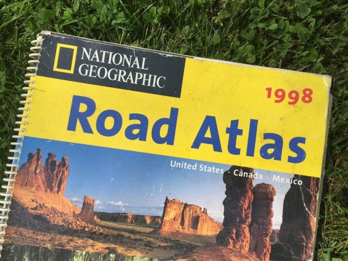
My favorite map I picked up remaindered at a book shop that is no longer around, sometime around the start of grad school in 1998. It is the whole US, one state per large gatefold, and I used it to cross the country several times in the years after college. What was great about it was that you could look at a state, figure out approximately where you would be landing at dusk, and find a back road off a back road on public land to put out a sleeping bag and spend the night. I still keep it in the back of the car, even though it’s inaccurate in the details, because the big highways are mostly still right.
For crops, this is the Farmer’s Almanac approach, wherein a guideline that was published in perhaps the 1960s by cooperative extension remains the operational guide for many growers. It hasn’t changed over time with new genetics or cultural practices, it’s not sensitive to the details of whether this is a hot year or a wet year or an early year. It won’t catch a black swan. But it’s okay usually. This approach is perhaps 90% of current practice for crop forecasting.
2. Sat Nav
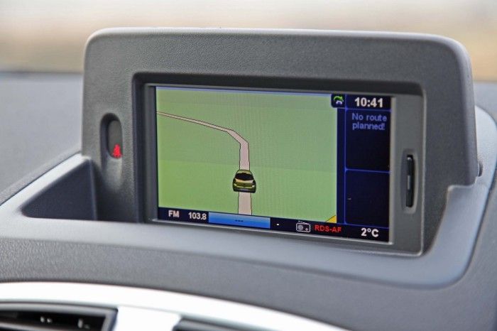
It’s an old saying that electronics and durable goods don’t mix, and nowhere is this more true than a 7 year old dashboard display with some Garmin map in your old Acura. You have to stop the car to program it one letter at a time, the roads need to be updated every year, they don’t take into account whether it’s midnight or rush hour, and certainly no road closures or accidents. Still, you plug in the destination and it tells you one route to get there, and a plausible estimate of how long it will take. Believe it or not, Uber and Apple navigation still work this way, without updating the timeline or route based on changing traffic conditions. The route is the route.
In agriculture, this mode of forecasting is about 10% of producers. It’s based somewhat on your local conditions but is cumbersome to use operationally. Forecasts may be based on varieties that are no longer even available (recall that the lifetime of a hybrid variety is just 4–7 years). Determining a forecast is probably based on an online degree-day calculator that through a convoluted series of dialogue boxes has you select a crop, perhaps a nearby weather station and delivers a hard-to-interpret table. The next time you check, you have to enter all the data again, there is no persistence. At best, there are research tools that take in satellite data up to the present date and use these to nudge the initial conditions of the model, but they are not using these to alter the coefficients that (say) turn sunlight into new biomass.
3. Google Maps / Waze
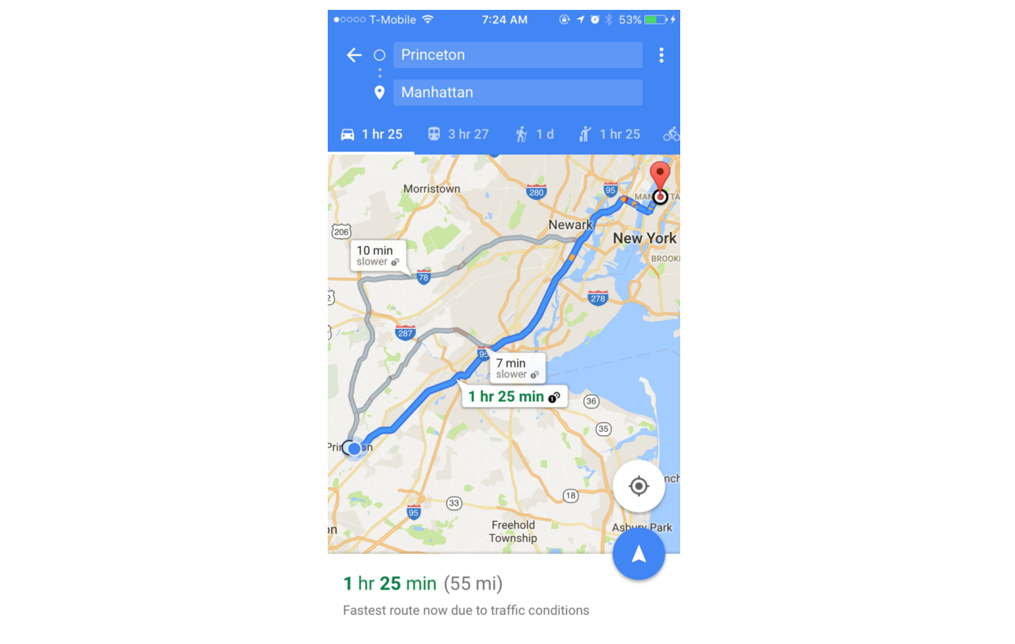
Google Maps is the pinnacle of forecasting. It’s extraordinary to know 90 minutes out that I will be 5 minutes late to a meeting and let them know, so I don’t sweat the whole ride stressed that I’m going to be late, arriving sweaty and apologetic that I wasted their time. Busy people cut it close, getting work done in those extra 5 minutes! What’s magic: not only does the forecast take into account the larger context of all those other drivers causing the traffic, by updating the time forecast or route, it also takes into account my driving pace and the specific traffic I encounter when updating the estimated time of arrival. It’s like knowing what the local microclimate is, plus knowing the response of my specific crop varieties.
This paradigm of continuous learning basically doesn’t exist in crop forecasting. But it’s easy to imagine the benefits: the grower knows far ahead of time the yield expectation, which helps in fertilization decisions or sales contracts, and the buyer knows ahead of time how much they are going to get and when. (Is this the Share My Location feature transposed into supply chain?) Actually, Google Maps has a trip planner so you can see when you would have to leave to arrive by a certain time. It would be an extraordinary means to reduce food and input waste if contract buyers could indicate when they want supply, and use forecasts in reverse to plan out planting dates. Here’s another idea: sell the variance from the forecasts to an insurer who is willing to take on weather based risk (often uncorrelated with other risks they may be exposed to). What it adds up to is a lot less waste and much more resource efficiency, both for the sellers and the buyers.
We’re able to make the Google Maps of crop forecasts because no one else collects the weather and crop growth data that we do. We are able to close the loop on machine learning with weather, using a proprietary device that measures an unprecedented array of microclimatic variables, including the big ones like rain and heat, but also the agriculturally important ones like evapotranspiration, canopy wetness, and photosynthetic light. These microclimatic textures in the production landscape are all but invisible, leading to variations in outcomes like post harvest lifetime that are uninterpretable without field data that led to those outcomes. More than just weather though, the Mark literally watches plants grow in response to that weather, so in addition to a weather forecast we predict crop growth based on actual measurements of plant responses to measured physical drivers. This adds up to a nuanced view of how a particular variety in a particular field is responding to the large-scale context of the weather events, and even to some extent shaping the weather itself.
Soon, we’ll get to the point where at any moment you could know when harvest is just as simply as you type in an address to find out how long it takes to get there. I know a few people who would sleep easier for that!